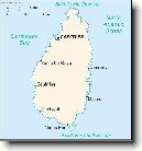
Město: La Croix Maingot, Region: Castries
|
Navigace mapy Celého Světa online: Kliknutím a tažením na mapě Celého světa, nebo použijte zoom kontrol.
Zeměpisná šířka: | 13,9500 (13°56'60.000"N) |
Zeměpisná délka: | -61,0000 (61°0'0.000"W) |
Nadmořská výška: | 29 m |
|
| |
|
|
|
|
GMT čas: -4 hodin | Posun oproti ČR: -5 hodin |
Vzdálenost města La Croix Maingot do 16 největších měst státu: Svatá Lucie
Vzdálenost města: La Croix Maingot do Top 10 měst světa
|
Přímá vzdálenost | Km |
| La Croix Maingot - Praha | 7 792 km |
| La Croix Maingot - Berlín | 7 731 km |
| La Croix Maingot - Londýn | 6 801 km |
| La Croix Maingot - Los Angeles | 6 145 km |
| La Croix Maingot - Moskva | 9 260 km |
| La Croix Maingot - New York | 3 234 km |
| La Croix Maingot - Paříž | 6 906 km |
| La Croix Maingot - Peking | 14 022 km |
| La Croix Maingot - Rio De Janeiro | 4 532 km |
| La Croix Maingot - Sydney | 16 093 km |
| La Croix Maingot - Tokio | 14 084 km |
Podpořte nás ·
Kontakt·
Kniha návštěv ·
RoboStav
Copyright (c) 2025 by CELÝSVĚT. Všechna práva vyhrazena!
Kontaktní e-mail: celysvet(zav)email.cz